 Catalogue PIGMA
10 m
Type of resources
Available actions
Topics
Keywords
Contact for the resource
Provided by
Years
Formats
Representation types
Update frequencies
status
Scale
Resolution
-
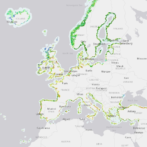
The Coastal Zones (CZ) LC/LU product for 2012 is providing a detailed Land Cover / Land Use (LC/ LU) dataset for areas along the coastline of the EEA38 countries and the United Kingdom, with reference year 2012 for the classification. This product monitors landscape dynamics in European coastal territory to an inland depth of 10 km with a total area of approximately 730,000 km², with all the relevant areas (estuaries, coastal lowlands, nature reserves). The production of the coastal zone layers was coordinated by the European Environment Agency (EEA) in the frame of the EU Copernicus programme, as part of the Copernicus Land Monitoring Service (CLMS) Local Component. The Coastal Zones product covers a buffer zone of coastline derived from EU-Hydro v1.1. Land Cover/Land Use (LC/LU) layer is extracted from Very High Resolution (VHR) satellite data and other available data. The class definitions follow the pre-defined nomenclature on the basis of Mapping and Assessment of Ecosystems and their Services (MAES) typology of ecosystems (Level 1 to Level 4) and CORINE Land Cover adapted to the specific characteristics of coastal zones. The classification provides 71 distinct thematic classes with a Minimum Mapping Unit (MMU) of 0.5 ha and a Minimum Mapping Width (MMW) of 10 m. The product is available for the 2012 and 2018 reference year including change mapping. This CZ dataset is distributed in vector format, in a single OGC GeoPackage SQLite file covering the area of interest. You can read more about the product here: https://land.copernicus.eu/en/products/coastal-zones/coastal-zones-2012.
-

The Coastal Zones LC/LU Change (CZC) 2012-2018 is providing the Land Cover / Land Use (LC/ LU) change for areas along the coastline of the EEA38 countries and the United Kingdom, between the reference years 2012 and 2018. The Coastal Zones product monitors landscape dynamics in European coastal territory to an inland depth of 10 km with a total area of approximately 730,000 km², with all the relevant areas (estuaries, coastal lowlands, nature reserves). The production of the coastal zone layers was coordinated by the European Environment Agency (EEA) in the frame of the EU Copernicus programme, as part of the Copernicus Land Monitoring Service (CLMS) Local Component. The Coastal Zones Change product covers a buffer zone of coastline derived from EU-Hydro v1.1. The Land Cover/Land Use (LC/LU) Change layer is extracted from Very High Resolution (VHR) satellite data and other available data. The reference years for the change are 2012 and 2018. The class definitions follow the pre-defined nomenclature on the basis of Mapping and Assessment of Ecosystems and their Services (MAES) typology of ecosystems (Level 1 to Level 4) and CORINE Land Cover adapted to the specific characteristics of coastal zones. The classification provides 71 distinct thematic classes with a Minimum Mapping Unit (MMU) of 0.5 ha and a Minimum Mapping Width (MMW) of 10 m. The status product is available for the 2012 and 2018 reference years. This CZC dataset is distributed in vector format, in a single OGC GeoPackage file covering the area of interest. You can read more about the product here: https://land.copernicus.eu/en/products/coastal-zones/coastal-zones-change-2012-2018.
-

The Coastal Zones (CZ) LC/LU product for 2018 is providing a detailed Land Cover / Land Use (LC/ LU) dataset for areas along the coastline of the EEA38 countries and the United Kingdom, with reference year 2018 for the classification. This product monitors landscape dynamics in European coastal territory to an inland depth of 10 km with a total area of approximately 730,000 km², with all the relevant areas (estuaries, coastal lowlands, nature reserves). The production of the coastal zone layers was coordinated by the European Environment Agency (EEA) in the frame of the EU Copernicus programme, as part of the Copernicus Land Monitoring Service (CLMS) Local Component. The Coastal Zones product covers a buffer zone of coastline derived from EU-Hydro v1.1. Land Cover/Land Use (LC/LU) layer is extracted from Very High Resolution (VHR) satellite data and other available data. The class definitions follow the pre-defined nomenclature on the basis of Mapping and Assessment of Ecosystems and their Services (MAES) typology of ecosystems (Level 1 to Level 4) and CORINE Land Cover adapted to the specific characteristics of coastal zones. The classification provides 71 distinct thematic classes with a Minimum Mapping Unit (MMU) of 0.5 ha and a Minimum Mapping Width (MMW) of 10 m. The product is available for the 2012 and 2018 reference year including change mapping. This CZ dataset is distributed in vector format, in a single OGC GeoPackage SQLite file covering the area of interest. You can read more about the product here: https://land.copernicus.eu/en/products/coastal-zones/coastal-zones-2018.
-
Représentation des points de comptage relatif aux trafics routiers sur les routes départementales de la Charente (16).
-

Base de données vecteur 2D couvrant l'ensemble du territoire métropolitain et les DOM. Il fournit l'information géométrique propre aux Ilots Regroupés pour l'Information Statistique. L'IRIS est la brique de base en matière de diffusion de données locales. Version 2 - Date de Publication : 2009
-
Cartes de végétations du CNES sur le territoire départemental des Pyrénées-Atlantiques datant de 1969, 1970 et 1976
-
Hiérarchisation du réseau routier départemental en fonction des caractéristiques de chaque section de route et de son usage. Le réseau routier est classé en quatre catégories. 1 Grandes liaisons 2 Réseau structurant 3 Réseau secondaire 4 Réseau d'intérêt communal
-

A compter de la rentée scolaire de septembre 2012, les élèves entrant au collège sont affectés à un établissement en fonction de leur adresse de résidence personnelle (et non en fonction de leur école primaire d'origine, comme auparavant). Cette couche décrit le secteur de recrutement des élèves pour chacun des 48 établissements. NB 1 : certains de ces établissements prennent en charge des élèves résidant dans des département limitrophes, et à l'inverse, certaines communes sont affectées à des établissement hors Pyrénées-Atlantiques. NB 2 : 8 communes font l'objet d'un découpage infra-communal, et donc couvertes par plusieurs établissements différents. Couche élaborée à partir de la BD Topo et BD Adresse IGN du RGE 2011 ©
-
Représentation des portions de routes départementales concernées par une restriction de circulation relative au tonnage sur le territoire de la Charente (16). Valeur de l'attribut : Définition B8 : Accès interdit aux véhicules affectés au transport de marchandises B8 RSR remorques et semi-remorques B8 SA Sauf autocar B8 SB Sauf bourg B8 UA Sauf usage agricole B8 SR Sauf riverain B8 SDL Sauf desserte locale B10a : Accès interdit aux véhicules, véhicules articulés, trains doubles ou ensemble de véhicules dont la longueur est supérieure au nombre indiqué B13 : Accès interdit aux véhicules, véhicules articulés, trains doubles ou ensemble de véhicules dont le poids total autorisé en charge ou le poids total roulant autorisé excède le nombre indiqué B13 RSR remorques et semi-remorques B13 SA Sauf autocar B13 SB Sauf bourg B13 SA-SB Sauf autocar et sauf bourg B13 SDL Sauf desserte locale B13 SR Sauf riverain
-
Représentation numérique des moyennes journalières concernant les trafics routiers sur les routes départementales de la Charente (16).